Raspberry Ridge
Elevation: 2360 m
Elevation Gain: 653 m
According to Peakfinder.com, Raspberry Ridge is so-named because “there must be raspberries on the ridge somewhere.” The summit of the ridge has been the site of an active fire lookout since 1954 when it replaced the, now abandoned, lookout atop nearby Mount Burke.
My Ascents:
May 4 2013
Trailhead: Raspberry Ridge Parking
With an improving forecast (at long last), the peak bagger’s eyes turn to the west, dreaming of scree and summits. After a failed attempt on Raspberry Ridge around this time last year with a much younger Crux in tow, I set my sights on its grassy snowy flanks once more.
.jpg)
The quintessential Alberta scene, taken along Highway 40 just west of Longview.
.jpg)
A very snowy objective! The fire lookout can be seen perched atop the ridge’s high point on the right hand side.
.jpg)
With the large snowpack this winter, the snow on the approach road was significantly deeper than it was at this time last year. Combined with the hot sun, the snow was sugary and awful. Nothing says fun like knee to waist-deep post-holing the entire approach!
.jpg)
Luckily I had Crux to break trail for me! He had a bit of a harder time staying on top of the snow this year than last. Click to see his trail-breaking efforts last year.
.jpg)
First views of the continental divide to the west from the approach fire snow road.
.jpg)
The normal hiking route to the top of the ridge veers left along the path shown here. This was the route that I attempted in the snow last year, only to be turned back by a large overhanging cornice near the top.
.jpg)
New year, same damned cornice! Not wanting history to repeat itself, I opted to attempt a different more south-facing route to the top this time around.
.jpg)
The south-facing grassy slopes (1 drainage further to the south than the usual hiking route) that I used to gain the ridge. The slope was a lot steeper than it looked from here, especially just below the ridge crest (click here to see a photo that Vern Dewit took from the top of the ridge, conveniently at the same point that I ascended). I managed to stay off the slippery slush until the very top, however, there was no avoiding it up high. Indeed, cresting the ridge may have involved an awkward-looking lunge over the waist-deep cornice remnants. Suffice to say, Crux pulled the move off with significantly more style.
.jpg)
Atop the ridge: another quintessential Alberta scene…
.jpg)
Crux enjoyed his seat on the picnic table just below the summit.
.jpg)
The fire lookout within striking distance.
.jpg)
Low altitude fly-by on the summit. The plane made a full turn around Crux and I, likely wondering what this idiot was doing dragging his dog up a ridge full of snow.
.jpg)
What’s that Crux? It’s a bird, it’s a plane. It’s actually a plane.
.jpg)
Flying off into the foothills.
.jpg)
The view from the fire lookout’s helipad. The helipad was mercifully free of snow and was delightful in the hot afternoon sun.
.jpg)
Looking north beyond Raspberry Ridge’s snowy ridge crest to the Highwood Range. Crux’s first hike (Grass Pass) is just right of the larger, whiter peaks.
.jpg)
Holy Cross Mountain. If this warm weather holds, it should be scramble-able in the very near future!
.jpg)
Looking northeast past the Bull Creek Hills to Calgary.
.jpg)
Testing out the zoom on my new camera.
.jpg)
Looking east over the cornice towards Mount Burke (center), Sentinel Peak and Plateau Mountain.
.jpg)
Mount Burke is also a great shoulder season outing, however, Raspberry Ridge is 8.4 km closer to the big peaks of the continental divide and the view is that much better from its summit!
.jpg)
Looking from one fire lookout to another.
.jpg)
Aptly named Plateau Mountain and surrounding scenery-marring clear-cuts.
.jpg)
Another summit for Crux!
.jpg)
Looking south along the High Rock Range towards the peaks of the Crowsnest Pass.
.jpg)
Highway 40 weaves its way along the base of the Highwood Range towards a distant Mist Mountain.
.jpg)
Mist Mountain - one of Crux’s more impressive summits.
.jpg)
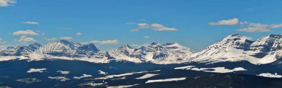
The panorama of the nearby continental divide to the west that makes the ascent of Raspberry Ridge really worthwhile. Click to see larger.
.jpg)
Nearby continental divide: Mounts Armstrong and MacLaren with flat-topped Mount Muir in the distance.
.jpg)
Nearby continental divide: Baril Peak.
.jpg)
Nearby continental divide: Mount Etherington.
.jpg)
Nearby continental divide: Mounts Farquhar, Holcroft and Scrimger
.jpg)
Nearby continental divide: Beehive Mountain and Mount Lyall.
.jpg)
Crux patiently enjoying his tea in the sun while the mad photographer was at work…
.jpg)
Working on my suntan BURN before heading back down and attempting to race to Canmore for dinner at 5:30pm (I got back down to my car at 3:00pm and made it with time to spare!).
.jpg)
Based on the uncomfortably steep nature of the slope that I ascended, I opted to descend 1 drainage further to the south (2 drainages south of the usual hiking route). The snow was still very steep up high but the route became more comfortable the further I got down. Eventually, once the slope throttled back a little, the snow on the left made for a pleasant first glissade of the season.
.jpg)
The view of my descent (left snow/grass drainage) and ascent (second snow/grass drainage from the left) slopes on the hike out to the car.
.jpg)
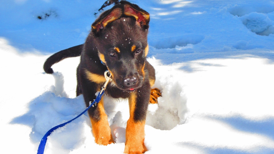
Tired puppy!
.jpg)