Powderface Ridge (Outlier)
Elevation: 2130 m
Elevation Gain: 630 m
Powderface Ridge is an 8 km long grass and tree-covered ridge which lies along the eastern edge of the front ranges. The ridge was officially named in 1949 for a Stoney aboriginal (Tom Powderface) who lived in nearby Bragg Creek.
My Ascents:
February 22 2014, Summer 1986.
Trailhead: Powderface Trailhead
After several weeks without a proper mountain excursion, I was running the risk of going stir crazy around the house. Despite frigid -20 C temperatures and overcast skies, I decided that Crux and I needed to get out! Because it was so cold, however, I had a hard time motivating myself to get going and, as a result, failed to get an alpine start. Without the luxury of wasting any additional time, I decided to head for the nearby Bragg Creek area of Kananaskis. Forgetmenot Mountain had caught my eye some time ago and I felt that this would make a suitable winter objective. Unfortunately, I somehow managed to forget that Highway 66 closes for the winter at Elbow falls and, as a result, found myself scrambling to come up with another objective when I could no longer reach the trailhead. I vaguely remembered a long approach to Powderface Ridge via Powederface Creek from hiking in the area with my parents as a child so I decided to see if I could find my way up Powderface Ridge based on 20+ year old memories. With a GPS along for the ride, I was sure that I could figure something out…
.jpg)
A slight miscalculation. In an effort to make the most of the day, I parked at the winter closure gates and made my way beyond them on foot for several hundred meters before reaching the marked Powderface Creek trailhead.
.jpg)
A promising start.
.jpg)
There are numerous approaches to Powderface Ridge, all of which are shorter and more pleasant than the ~8 km Powderface Creek approach. While I had hiked up the ridge several times as a child, I had generally done so by the shorter and less monotonous routes which start further up the highway beyond the winter closure. In fact, there was a good chance that I hadn’t hiked this particular trail since my first successful summit at the age of 3.
.jpg)
The ridge begins to reveal itself ahead. Unfortunately, it was at this point that my GPS batteries died. Without the benefit of GPS, I had no way of knowing which of the many hills and ridges surrounding the tree-filled approach valley was actually Powderface Ridge.
.jpg)
Taking a break on approach.
.jpg)
After several hours in the cold, I finally arrived at a pass beyond which there was no broken trail to follow. Without a trail, a GPS or a good view of the surroundings, I aimed for the most obvious high point immediately south of the pass hoping that this was, in fact, Powderface Ridge.
.jpg)
Crux makes his way up the open slopes towards, what we hoped was, the summit.
.jpg)
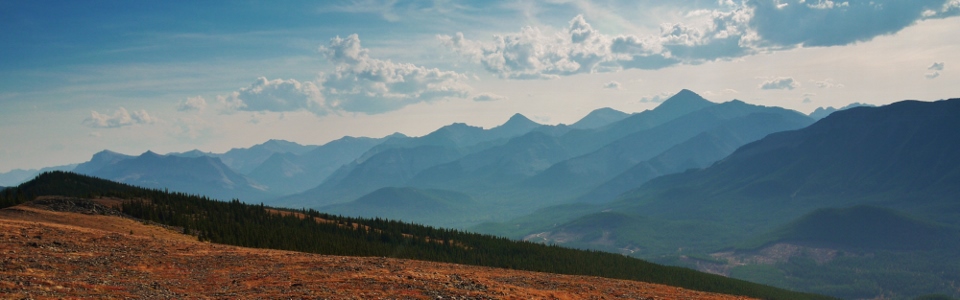
Faint views of Nihahi Ridge to the west suggest that we’re in the right vicinity at least.
.jpg)
Small conifers and an equally unimpressive cornice on the “summit.”
.jpg)
From the “summit,” we were finally able to see this adjacent ridge to the southeast. This ridge had been obscured by trees until now. Upon consulting topo maps when I returned home, I was disappointed to discover that this was actually Powderface Ridge and that we had somehow ended up on an outlier that was 80 vertical meters lower than the ridge’s high point. Grumble grumble…
.jpg)
At least the “views” were worth the effort (grumble, grumble)…
.jpg)
Chilly summit selfy. We didn’t linger long nor was it particularly tempting to do so.
.jpg)
Cold summit outlier puppy.
.jpg)
Of course, as so often happens, the sun finally came out once we had descended back down to the pass and were about to return to the shade of the trees for the remainder of the ~8 km walk back to the car.
.jpg)
One of the few “views” from the uninspiring plod out.
.jpg)
Back at the car with some winter highlights in my beard. Not the most remarkable day out but, at this point in the winter, it was a day out and that’s better than nothing!