Raspberry Ridge
Elevation: 2360 m
Elevation Gain: 653 m
According to Peakfinder.com, Raspberry Ridge is so-named because “there must be raspberries on the ridge somewhere.” The summit of the ridge has been the site of an active fire lookout since 1954 when it replaced the, now abandoned, lookout atop nearby Mount Burke.
Trailhead: Raspberry Ridge Parking
My Ascents:
June 8 2014, May 4 2013
After a spectacular early season solo scramble at the Columbia Icefields a couple of days earlier, I decided that a closer objective with better company was in order as a follow-up. Seeking a family-friendly summit, Brianne and I decided to suggest an ascent of Raspberry Ridge and were delighted when 3 out of our 4 parents agreed to join us (and Crux).
.jpg)
The Hobbs – Christison crew enjoying the summer sun on approach.
.jpg)
First views of the target on approach. I’m still not used to seeing it snow-free!
.jpg)
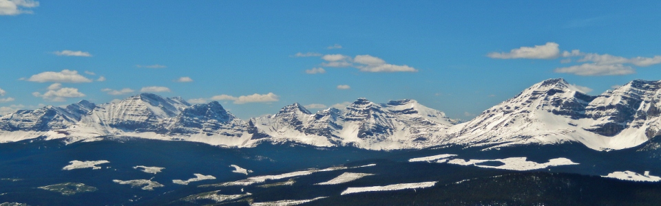
Sneaking a peak at the larger peaks to the west of Raspberry Ridge on ascent.
.jpg)
Brianne and I pose by the cairn which marks the beginning of the steep hike up Raspberry’s flank. In years passed, I’ve never been able to actually follow the trail since it was always buried under snow. Who knew that it was so steep?!
.jpg)
While we spotted a great many crocuses, we did not encounter a single raspberry; curious.
.jpg)
Following a quick but steep ascent, we crossed the remnants of a cornice and gained the scenic ridge crest.
.jpg)
Spring in the front ranges of the Canadian Rockies!
.jpg)
The final, easy hike to the summit fire lookout.
.jpg)
Mounts Armstrong and McClaren dominate the view to the northwest.
.jpg)
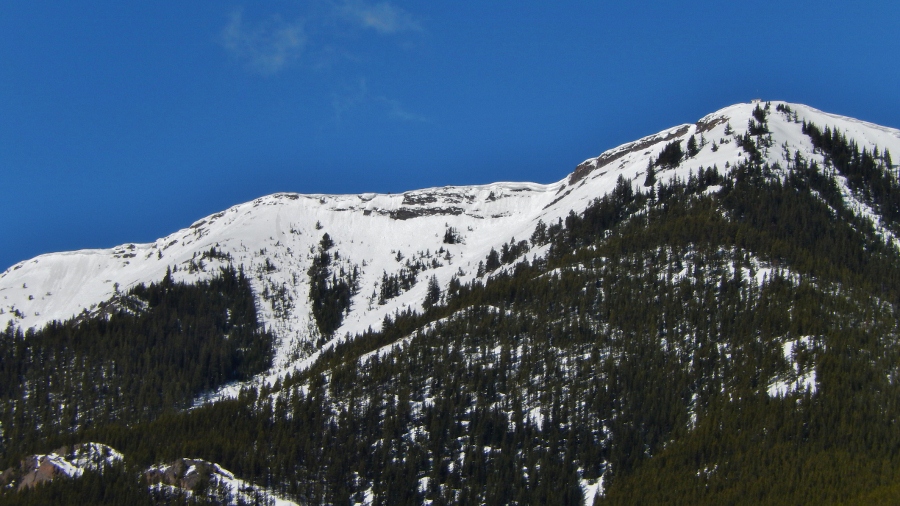
Winter has yet to relinquish its grasp on Baril Peak.
.jpg)
Mounts Farquhar, Holcroft and Scrimger above a scenery-marring clear-cut.
.jpg)
Mount Etherington.
.jpg)
Mom enjoying the view (but more so the company).
.jpg)
Mount Head and Holy Cross Mountain immediately north.
.jpg)
Foothills give way to prairies in a typical front range scene.
.jpg)
Mist Mountain.
.jpg)
Looks like the old man can still climb! ;-)
.jpg)
Taking a nap while the photographer gets carried away (as per usual).
.jpg)
That’s cheating! We had to walk up!
.jpg)
After dropping off its load, the helicopter quickly retreated passed flat-topped Mount Muir. No free ride down today. :-(
.jpg)
Mom getting ready to head down on her own (sans helicopter assist).
.jpg)
A distant Crowsnest Mountain just visible to the south.
.jpg)
Burke Mountain and Plateau Mountain immediately east.
.jpg)
Last views of the larger peaks to the west before heading back down.
.jpg)
More cornice on descent.
.jpg)
More crocuses on descent.
.jpg)
After making our way down the steep slope, the relatively flat approach trail (which seemed so short on the way in) seemed to stretch on forever on the way out (don’t they always?).
.jpg)
After a pleasant day with the family, we were happy to end on a high note. No, I’m not referring to these flowers; I am referring to the requisite stop for amazing milkshakes at the Hitching Post in High River! Mmmm…milkshakes…