Having stood on 149 different summits up to this point in my life, I was looking for an absolute gem of a peak to mark my milestone 150th summit upon. Happily, Smutwood Peak possesses a rare combination of features which instantly qualify it for “gem” status! Firstly (and most importantly), this jewel of a mountain is located amidst some of the most spectacular scenery that the Canadian Rockies have to offer. Secondly, the ascent of Smutwood is relatively easy (both technically and physically) making it accessible to a wide range of hikers, scramblers and even mountain dogs. Thirdly (and shockingly given the peak’s aforementioned accessibility and high octane scenery), Smutwood is not particularly well-known and does not attract a crowd. I crave peaks like Smutwood; peaks that are relatively unknown and provide an amazing reward for the effort expended.
For all of these reasons, Smutwood has been on my mind for some time. As a result, when fellow peak-bagger Doug Lutz sent out a mass e-mail seeing if anyone was interested in a mid-week ascent of Smutwood, I was quick to reply. As Doug and I e-mailed back and forth, I was able to persuade him to rearrange his schedule so that we could tackle Smutwood on my regular Friday off work, which was looking to be a spectacular day from a weather perspective. While the logistics of 2 people (and 1 dog) climbing Smutwood needn’t be complicated, Doug devised an additional wrinkle which would make the planning process more involved; while in the area, he also wanted to climb the Fist. Since I would have Crux in tow on this day, a difficult scramble like the Fist was obviously out of the question for me. Keen to bag both peaks, Doug informed me that he would, therefore, sleep in his car at the trailhead and ascend the Fist by headlamp at 3:00 am in the hopes of making his way back down to the shared Commonwealth Creek approach trail by the time that Crux and I were starting our hike up. Clearly Doug is nuts and I told him as much. I also told him that I’d see him along Commonwealth Creek around 8:30 am and wished him luck on the Fist!
.jpg)
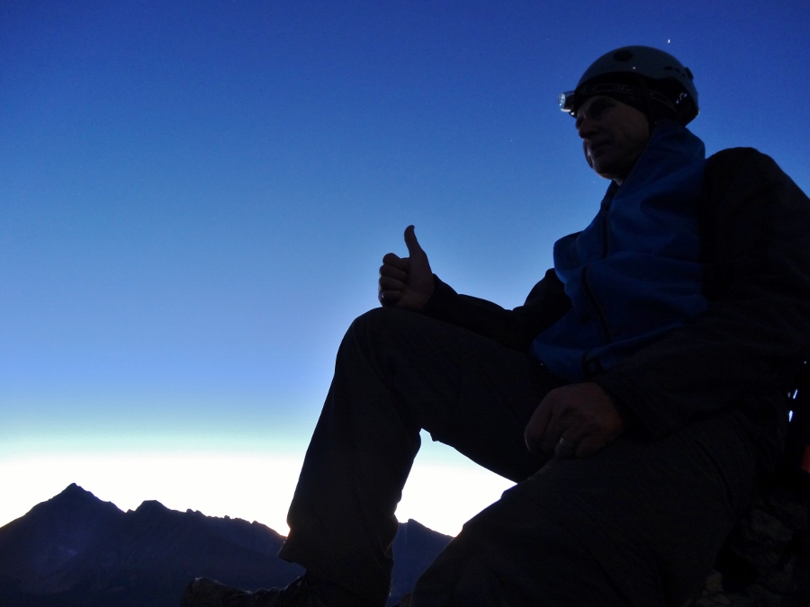
Having “slept in” until 4:15 am, I made my way west towards the mountains in the pitch black arriving at the top of White Man’s Gap above Canmore around 6:30 am. As the first light of dawn appeared on the horizon to the east, I wondered how Doug was doing (now over 3 hours into his nocturnal ascent of the Fist).
.jpg)
As I arrived at the Commonwealth Creek trailhead (just beyond the Mount Engadine Lodge), I was treated to an awesome display of alpenglow on Mount Birdwood’s impressive north face. By this time (7:30 am), Doug had already summited the Fist and was on his way back down to meet me.
.jpg)
After hiking along an old logging road for about 30 minutes, I arrived at a frosty fork in the trail and followed the right-hand branch towards Commonwealth Creek.
.jpg)
As the trail approaches the noisy creek, the road quickly shrinks and a narrow trail ascends through forest on the sometimes steep northern bank.
.jpg)
After a short forested stint alongside the creek, the valley opens up granting beautiful views towards the sun-kissed faces of Mount Birdwood (center left), Mount Smuts (center right) and the Fist (right). From here, the trail continues along the open meadow and will ascend the distant pass between Mounts Birdwood and Smuts. Click to see larger.
.jpg)
The full moon sets behind Mount Smuts.
.jpg)
As I made my way further up the valley, I was urged on by beautiful views, like this one of Mount Birdwood reflected in a semi-frozen Commonwealth Creek.
.jpg)
Doug Lutz, I presume? Having successfully summited the Fist before most working folk were out of bed, I found Doug waiting for me in an open area at 8:30 am. After a quick break (which he was more entitled to than I), we made our way up the steep, shaded headwall to the climber’s right of Mount Birdwood discussing mountains and other matters.
.jpg)
After a steep, chilly grind up the pass separating Mount Birdwood from Mount Smuts, Crux and I paused to enjoy the warmth of the sun once we finally escaped the shade of the valley (Photo courtesy DL).
.jpg)
A good look at the scramble route (widely considered the most difficult route in Kane’s guide) up the south ridge of Mount Smuts. Even Doug thought this looked crazy!
.jpg)
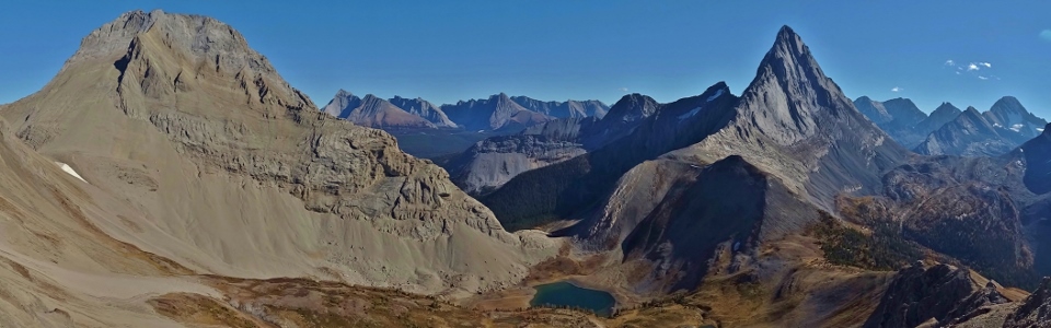
Beyond the sunny (but windy) pass (lower right), we traversed above the cerulean Birdwood Lakes towards Smutwood Pass (upper left). Smutwood Peak is the pointy summit near the center of the panorama and the route up it involves little more than delightful hiking along the intervening ridge. All the while, views of Mount Smuts (right) and the Birdwood Lakes provide an excuse for frequent photography breaks. Click to see larger.
.jpg)
In a couple of spots, the ridge looks like it may get scrambly but, until just below the true summit, this is an illusion (DL).
.jpg)
Awesome views of Mount Smuts (DL).
.jpg)
Looking down the ridge into the emerald depths of Upper Birdwood Lake (DL).
.jpg)
Crux and I make our way along the pleasant ridge towards the false summit and the true summit (which looks lower from here) beyond. Click to see larger (DL).
.jpg)
While Doug, Crux and I all got off to an alpine start, this lazy goat decided to stay in his ledge bed all morning.
.jpg)
Following a good trail, we contoured around the false summit. Once around, the true summit was only a short slog away. On the left, Mount Assiniboine makes its first appearance of the day while Mount Smuts (on the right) is now a familiar companion. Click to see larger (DL).
.jpg)
Looking west beyond Mounts Warre (left) and Currie (right) towards Red Man Mountain (center), Mount Alcantara (center right) and Eon Mountain (right) from just below the summit of Smutwood Peak.
.jpg)
Mount Birdwood and its namesake lakes provide a spectacular backdrop as Doug ascends the final few meters to the summit.
.jpg)
As stunning a summit scene as any that I’ve seen from the 149 that came before it! This is the view that makes Smutwood Peak an absolute gem (DL)!
.jpg)
What a panorama! From left to right: Mount Sparrowhawk (distant), massive Mount Smuts, Mount Chester, Commonwealth Peak, dogtoothed Mount Birdwood, Mount French, Mount Robertson, Whistling Rock Ridge, Mount Sir Douglas and Snow Peak. Click to see larger.
.jpg)
The beautiful Birdwood Lakes glisten in the sun below (DL)...
.jpg)
…while Doug glistens in the sun above!
.jpg)
The panorama to the west overlooks the Upper Spray River Valley and a host of infrequently visited peaks. From left to right: Whistling Rock Ridge, Mount Sir Douglas, Snow Peak, Mount Cradock, Mount King George, Mount Back, Mount Queen Elizabeth, Mount King Albert, Mount Leman, Mount Queen Mary, Lockwood Peak, Leman Lake, Mount Leval, Sharkfin Peak, Mount Vavasour, White Man Mountain, Mount Warre, Red Man Mountain, Mount Alcantara, Mount Currie, Eon Mountain, Mount Aye, Mount Byng and Mount Assiniboine. Click to see larger.
.jpg)
A closer look at Leman Lake with the glaciated Royal Group beyond to the left and Mount Leval, Sharkfin Peak, Mount Vavasour and glaciated White Man Mountain to the right (DL).
.jpg)
Crux enjoys his sunny summit stay.
.jpg)
A closer look at dramatically-shaped Sharkfin Peak (DL).
.jpg)
The reddish slopes for which Red Man Mountain was named.
.jpg)
Group summit photo. When we ran into Doug in the valley earlier in the morning, Crux wasn’t sure what to make of him but after Doug “donated” a couple of PB&J sandwiches on the summit, he had a new best friend (DL)!
.jpg)
The adjacent summit to the west looked to be of similar height so Doug wandered over along the exposed ridge to verify its altitude with his GPS while I Crux ate his lunch.
.jpg)
Doug wanders right on back after confirming that the more western high point was 1 m lower than the summit that Crux and I decided to stay on.
.jpg)
A closer look at the giants Eon, Aye and Assiniboine beyond Mount Byng. On this spectacular day, the only cloud in the sky was the small lenticular cloud forming above Assiniboine (DL).
.jpg)
A clear panorama to the north. From left to right: Red Man Mountain, Mount Alcantara, Mount Currie, Eon Mountain, Mount Aye, Mount Byng, Mount Assiniboine, Terrapin Mountain, the Towers, Mount Morrison, Mount Turner, the Bryant Creek Valley, Mount Mercer, Cone Mountain, Mount Shark, Old Goat Mountain, Mount Nestor, Mount Lougheed (I and II), Mount Sparrowhawk and Mount Smuts. Click to see larger (DL).
.jpg)
The twin summits of Mount Lougheed (center) and the single summit of Mount Sparrowhawk (right) dwarf Mount Fable (far left), the Windtower (left) and Mount Buller (right) beyond the Smuts – Shark col.
.jpg)
After a lengthy summit stay, Doug and I set up one last summit photo together before getting the descent underway (DL).
.jpg)
The best part about hiking down the ridge from the summit was that we were able to spend the entire time staring out at the million dollar view of Mount Birdwood and the Birdwood Lakes below (DL)!
.jpg)
Since Doug hadn’t already bagged enough peaks on this day, he decided to make his way up Smutwood’s false summit as well!
.jpg)
While Doug explored the false summit, Crux and I stayed below and played on the small permanent snow patch. Crux had snow much fun (DL)!
.jpg)
After contouring back around the false summit, Crux and I met back up with Doug and resumed our slack-jawed gawking in the direction of Mount Birdwood.
.jpg)
With my 150th summit complete, perhaps the aesthetic Mount Birdwood will be my 151st? Wonder if the northwest ridge can be climbed? Oh – never mind (DL)!
.jpg)
Bluebird days in the Rockies make Crux happy!
.jpg)
Still enjoying the views of Whistling Rock Ridge (left) and Mount Sir Douglas (obvious) from back down at Smutwood Pass.
.jpg)
Although the trail does not pass directly by the Birdwood Lakes, Crux insisted upon making a side trip to visit them. As you can see, once there, he “enthusiastically” went for a dip.
.jpg)
Making our way along the small stream connecting the two Birdwood Lakes. Mount Galatea (the highest peak in the Kananaskis Range) is visible in the distance.
.jpg)
Looking back to scenic Smutwood Peak from lower Birdwood Lake.
.jpg)
It’s all over but the longish hike out! After enjoying 150 different summits (and counting), I can safely state that scenery doesn’t get any better than that offered on breathtaking Smutwood Peak!
NOTE: All photos marked with a (DL) above are courtesy Doug Lutz. Thanks to Doug for generously sharing his pictures after I experienced some battery-related performance problems with my camera!
.jpg)
.jpg)
.jpg)
.jpg)
.jpg)
.jpg)
.jpg)